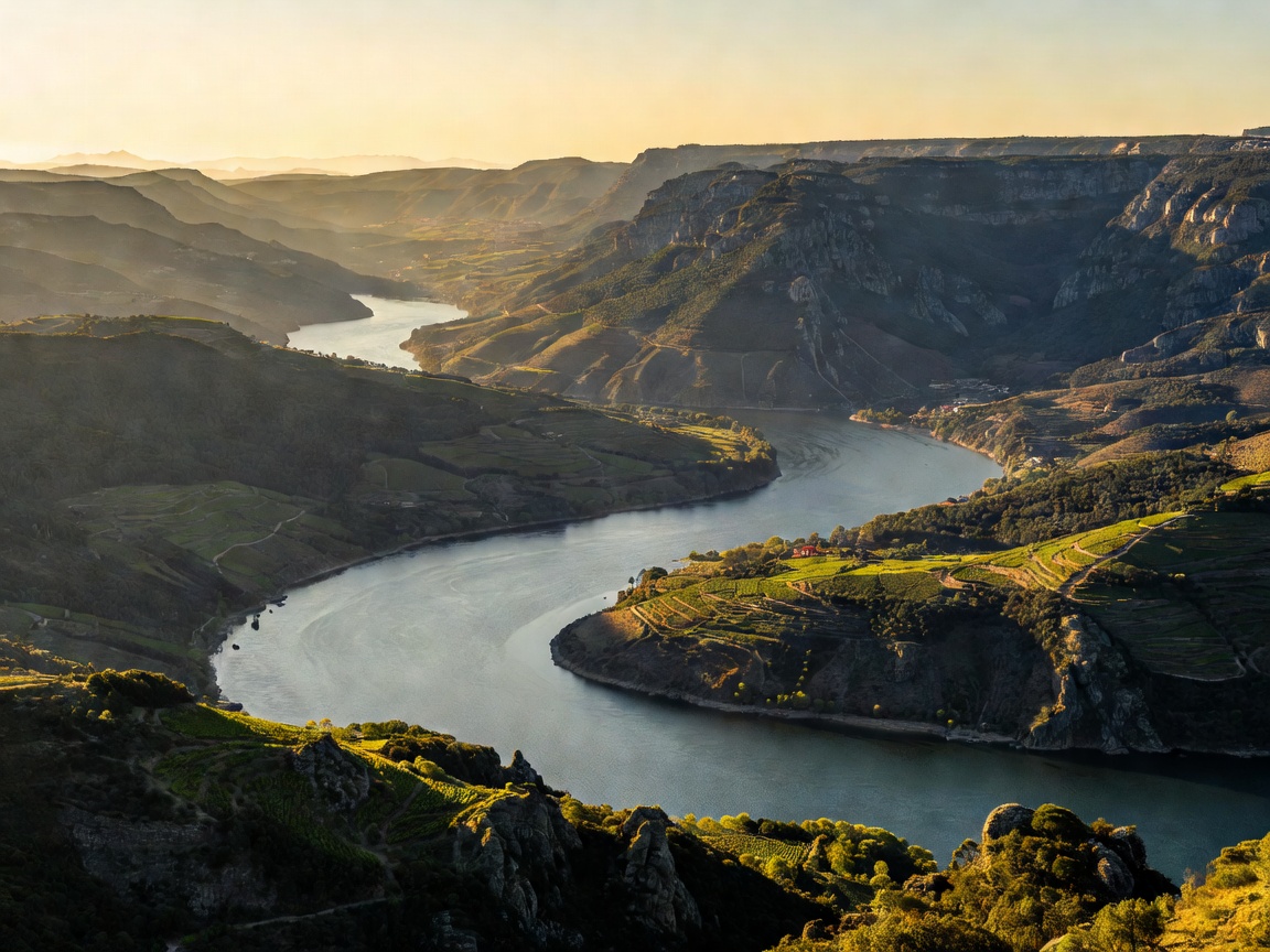
1. The Headwaters: Glacial Origins in the Sierra de Urbión
The river begins its course at an elevation of approximately 2,160 metres in the Iberian System mountain range, specifically within the municipality of Duruelo de la Sierra in the province of Soria, Spain. Emerging as small mountain runoff from the Laguna Negra glacial plateau, it flows south through alpine pinewoods before collecting tributaries and turning westward across the vast, arid Meseta Central plateau of Castile and León.
In its high Spanish stretch, known locally as the Duero, the river irrigates continental farmland and flows past historic episcopal capitals including Soria, Aranda de Duero, Tordesillas, and Zamora. In this central span, the river displays classic meandering characteristics across alluvial plains before abruptly encountering the hard Hercynian granitic shield along the Portuguese border.
2. The International Border: The Canyons of the Arribes
For roughly 112 kilometres, the Douro serves as the international boundary separating Portugal and Spain. Here, the river experiences its most dramatic vertical drop, carving canyons up to 400 metres deep through crystalline granite and schist. This border section, known as the Douro Internacional on the Portuguese side and Arribes del Duero on the Spanish side, forms a microclimatic barrier where extreme thermic retention supports Mediterranean flora amidst continental surroundings.
Due to the fierce drop in elevation over short distances, this border canyon proved impossible to navigate in pre-industrial antiquity, yet it today hosts significant cross-border hydroelectric agreements established under bilateral treaties between Madrid and Lisbon during the mid-20th century.
Geographic Route Comparison: Spanish vs. Portuguese Sectors
| Parametric Criterion | Spanish Sector (Duero) | Portuguese Sector (Douro) |
|---|---|---|
| Linear Channel Distance | 572 km (~64% of total) | 325 km (including 112 km border corridor) |
| Topographical Context | Castilian high plateau & wide limestone plains | Steep schist valleys, narrow gorges & estuary |
| Primary Urban Settlement | Soria, Zamora, Aranda de Duero | Peso da Régua, Pinhão, Lamego, Porto, Gaia |
| Commercial Waterway Function | Agricultural irrigation & municipal reservoir | Class IV inland waterway, cargo & passenger river cruises |
| Climate Regime | Continental extreme (scorching summers, freezing winters) | Sub-Mediterranean interior shifting to Atlantic oceanic |
3. The Portuguese Incline: From Barca d'Alva to the Atlantic
The river leaves the international boundary near Barca d'Alva, plunging completely into Portuguese territory for its final 213 kilometres. It traverses the districts of Guarda, Bragança, Viseu, Vila Real, and Aveiro before culminating between the municipalities of Porto and Vila Nova de Gaia.
Throughout northern Portugal, the river is sustained by major tributaries that descend from surrounding mountain chains: the Tua and Corgo rivers flowing down from the Serra do Marão and Serra de Montemuro, and the Côa and Paiva rivers contributing from the south. The convergence of these violent mountain currents historically produced turbulent rapids and dramatic seasonal flow variations, with winter discharges spiking up to fifteen thousand cubic metres per second during catastrophic flood events.
4. The Hydrological Taming: Modern Dams & Navigation Locks
Prior to hydraulic engineering projects initiated in the 1960s, navigating the Douro was perilous. Seasonal droughts made the river impassable in summer, while winter torrents pulverized traditional wooden flat-bottomed craft. The installation of five major dam complexes transformed the river into a stepped aquatic staircase:
- Pocinho Dam (1982): Marks the eastern limit of modern passenger navigation, providing 22 metres of vertical lock lift.
- Valeira Dam (1976): Sits directly upstream of the historic Cachão da Valeira gorge, conquering a 33-metre elevation step.
- Bagaúste Dam (1973): Positioned at Peso da Régua, operating a 27-metre lift chamber that links central wine estates with downstream processing.
- Carrapatelo Dam (1971): Features Europe's deepest commercial ship lock with a dramatic 35-metre single-stage descent.
- Crestuma-Lever Dam (1985): The lowest barrage, located roughly 22 kilometres from the mouth, preventing tidal salinization of upstream drinking reservoirs.
5. Strategic Importance to Modern Portugal
Today, the Douro basin accounts for nearly 20% of Portugal's entire territory. Beyond its prestige as the cradle of Port wine production, the river supplies nearly 18% of the nation’s domestic hydroelectric generation and provides critical municipal drinking water supplies to over two million residents in the Greater Porto metropolitan region.